
WHAT WE DO
OUR SERVICES
Non-destructive investigation across concrete, structures, utilities and infrastructure — grouped so you can find the right survey fast. Every job is quoted per project; no online payment.
01 Concrete and rebar - LOCATE BEFORE YOU CUT
3D Concrete Scanning & Rebar detection
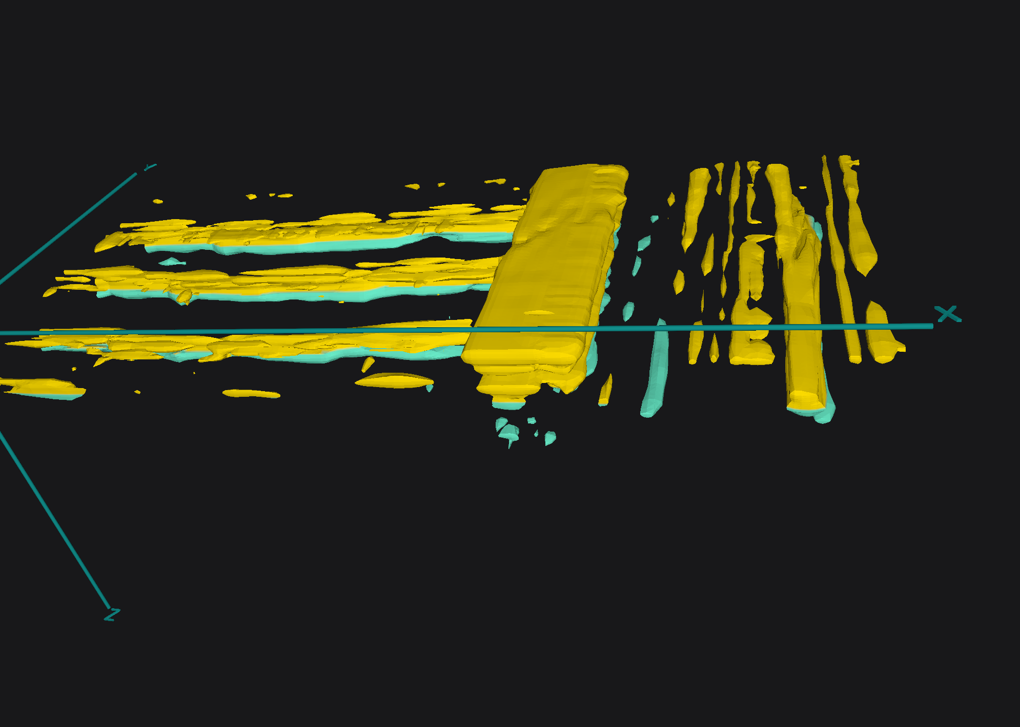
High-resolution GPR that maps reinforcement, post-tension cables, ducts and embedded services within concrete and reconstructs them in 3D.
We scan slabs, beams, columns, walls and foundations and mark findings onto the surface — so you can core, cut and drill with confidence, with no strikes to critical elements and engineer-ready reporting to back it up.
Proceq augmented-reality scanning that overlays detected reinforcement, tendons, ducts and services directly onto the concrete surface in real time — a genuine see-through view of the structure.
Plan intrusive works with 1:1 visual verification, share clear 3D visuals with your team, and cut the risk of strikes, all backed by detailed GPR interpretation and reporting.
3D AUGMENTED REALITY Concrete SCANNING
03 Testing & Integrity - assess condition & health
NON-DESTRUCTIVE TESTING (NDT)
Detailed assessment of concrete condition and structural health with no damage to the asset.
We combine UPV, Schmidt hammer, half-cell potential and resistivity testing to evaluate strength, durability and corrosion risk — delivering engineer-ready reporting that identifies weak zones and internal defects and supports remaining-life and repair decisions.
STRUCTURAL VOID DETECTION
Non-destructive location of voids, honeycombing and delamination within and behind concrete — without breaking out. Using GPR and complementary NDT methods we find air gaps beneath slabs, voids around ducts and anchorages, and delamination in decks and structures, marked on site and reported for engineers so you can target repairs and grouting accurately.
Precision 3D crackmeter and tilt-sensor monitoring that records structural movement continuously over time.
We capture displacement and rotation across the areas of concern, revealing whether defects are active or stable and at what rate they're moving — the evidence engineers need to plan repairs with confidence.
3d structural crack and tilt wireless monitoring
CONCRETE HALF - CELL POTENTIAL SURVEY
A non-destructive electrochemical survey that maps reinforcement corrosion probability across slabs and decks.
By measuring steel potential across a grid, we identify active corrosion — often before it shows on the surface — and present clear high-, medium- and low-risk maps, so you can target repairs precisely and prioritise maintenance where it matters most.
A fast, non-destructive test that verifies pile length and integrity without excavation, using the Proceq Pile Integrity Tester.
A light hammer impact sends a stress wave down the pile and the refelcted echo reveals its length and flags defects - cracks, necking, voids or changes in section. Ideal for checkingas-built records and assessing foundations on existing structures, with engineer-ready reporting.
PILE ECHO (PIT) TESTING
BRIDGE DECK,TUNNEL & CIVIL INFRSTRUCTURE
High-fidelity, non-destructive investigation of bridge decks, tunnels and complex civil assets.
We combine GPR and NDT to map reinforcement, cover and post-tension ducts and to detect delamination, moisture, corrosion and voids across large structures — with minimal disruption. The result is engineer-ready data for condition assessment, maintenance planning and remedial design.
02 UTILITY & DIGITAL - MAP THE SITE AND SUBSURFACE
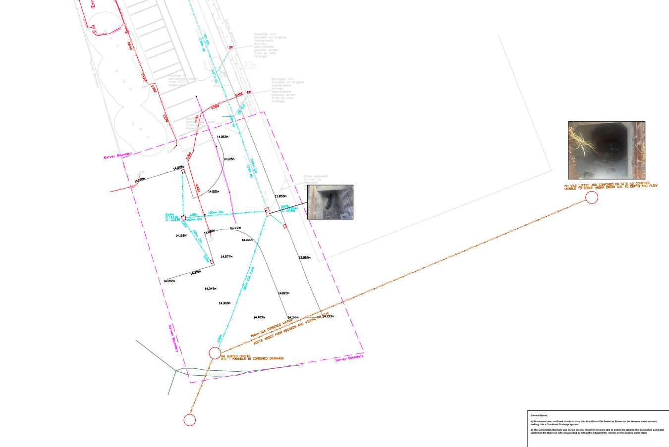
PAS128 UTILITY & SUBSURFACE SURVEYS
Detection and mapping of buried utilities before you excavate, to PAS 128:2022 and HSG47.
We combine GPR and Electromagnetic Induction to locate metallic and non-metallic cables, pipes, ducts and drainage, recorded at PAS 128 quality levels. Findings are marked on site and delivered CAD/BIM-ready — so you can dig safely, avoid utility strikes and prevent delays.
MATTERPORT 3D SCANNING & DIGITAL TWIN
A fully measurable, photo-real 3D digital twin of your site — with all our investigation data embedded inside it. Using Mattertags we pin GPR scans, utility mark-ups, NDT results, reports and 3D imagery to their exact locations, so every finding lives in context. Ideal for as-built records, planning, remote collaboration and a rich interactive dataset your team can revisit anytime.
gps & topographical surveys
Survey-grade GNSS/GPS and total-station surveys that capture accurate site levels, features and topography — and geo-reference our GPR, utility and structural findings to real-world coordinates.
Delivered as topographic surveys, contour data and georeferenced maps, CAD/BIM-ready for design, setting-out and construction planning.
04 TRAINING - UPSKILL YOUR TEAM
CONCRETE SCANNING TRAINING
Hands-on training in GPR concrete scanning and interpretation — from data capture to reading reinforcement, cover, post-tension and services, including AR integration. Practical instruction on your own equipment (GSSI, Proceq, Screening Eagle) to build real site confidence.
UTILITY SURVEYING TRAINING
Hands-on training in utility detection and mapping to PAS 128 — GPR and Electromagnetic Induction (EMI) methodology, safe mark-out practice (HSG47) and damage prevention — giving your team the skills to locate buried services reliably.
Practical instruction in non-destructive testing methods and reporting — UPV, Schmidt hammer, half-cell potential and resistivity — covering correct procedure, data interpretation and engineer-ready reporting so your team can test and assess concrete with confidence.
3D - NDT TRAINING
NOT SURE WHICH SURVEY YOU NEED
Tell us about your project and we'll recommend the right approach and give you a fixed-fee quote.